Deep-Sea AUV Mission Planning for Mineral Exploration and Oceanographic Survey
News Details
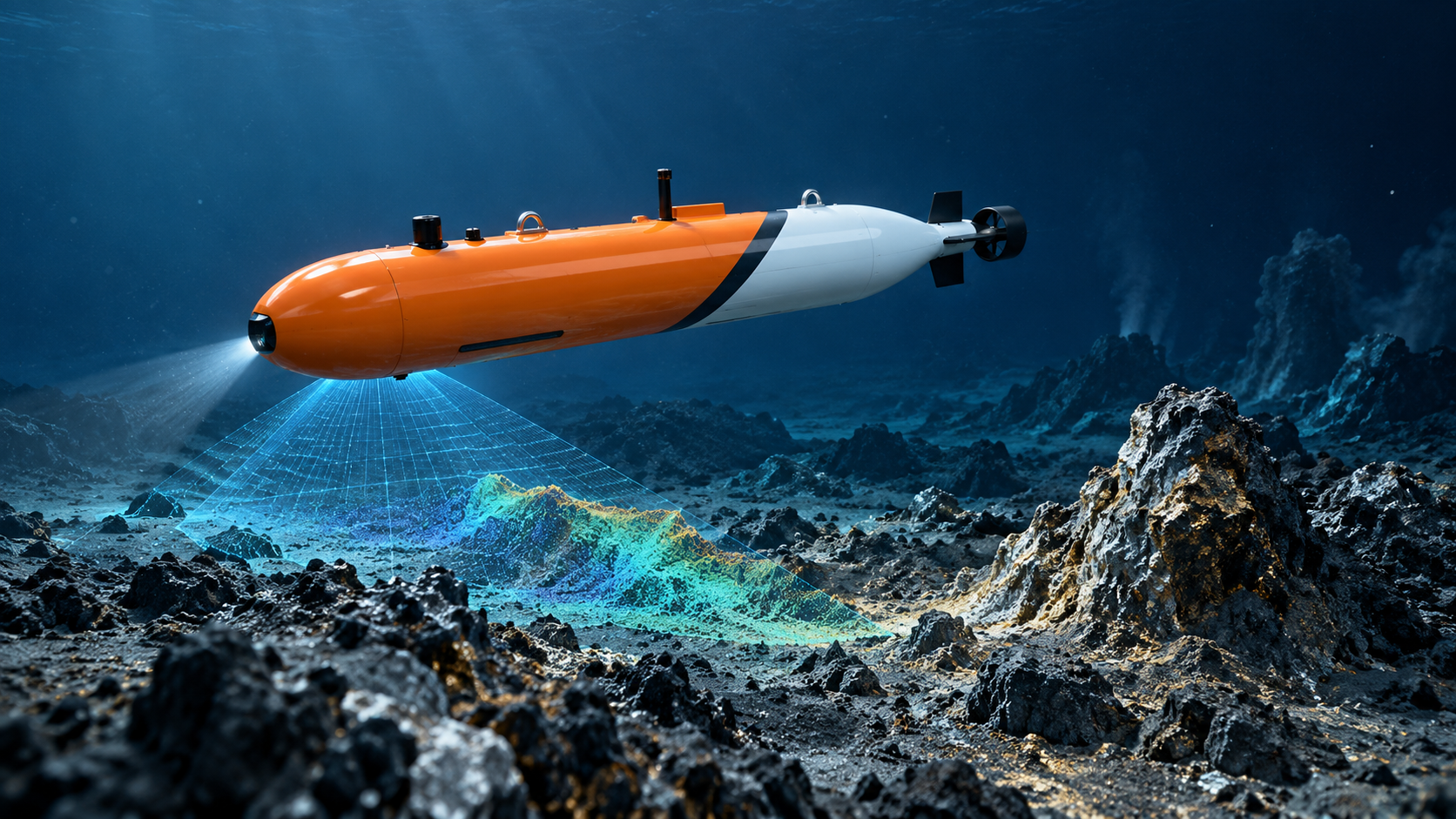
Deep-sea work is complex, costly, and full of unknowns. Mineral exploration teams need to map large seabed areas. Oceanographic teams need to collect data across deep water layers. At the same time, ships, crews, and weather windows are limited. Therefore, every underwater mission must be planned with care.
AUVs are now an important tool for this work. A 6000m AUV can reach deep seabed zones that are difficult for many other platforms. A long endurance AUV can cover wider survey areas with less support. Also, a seabed mapping AUV can collect high-value data for science, engineering, and resource assessment.
For PELAGIX, deep sea AUV mission planning connects vehicle design, navigation, sensors, software, and marine data into one practical workflow.
Why Deep-Sea Mission Planning Matters
In shallow water, teams may have more room to adjust plans during the job. In deep water, however, changes are harder. The AUV may operate far below the vessel, where pressure is high, light is absent, and communication is limited.
Because of this, mission planning must answer key questions before launch. Where should the AUV go? How deep should it fly above the seabed? Which sensors should be used? How much battery reserve is needed? Where should the vehicle return?
Good planning reduces risk. It also helps the AUV collect cleaner data with fewer gaps. As a result, teams can save vessel time and improve mission success.
6000m AUV for Deep-Sea Exploration
A 6000m AUV is designed for the extreme pressure and distance of deep-sea missions. This depth range can support surveys in many ocean basins, including areas used for scientific research, seabed mapping, and mineral exploration.
At great depth, the AUV must work with strong structure, stable control, reliable navigation, and flexible payload options. Since there is no natural light, imaging and sonar tools are also important.
PELAGIX offers the AUV-600 intelligent large AUV system for deep-sea exploration, marine engineering surveys, and scientific research. According to PELAGIX product information, the AUV-600 supports 6000m depth capability, intelligent coordination, and modular payload integration.
Long Endurance AUV for Wider Survey Coverage
Deep-sea missions often cover large areas. For example, mineral exploration may require long survey lines across the seabed. Oceanographic survey may require repeated profiles or broad data collection over a defined region.
A long endurance AUV helps teams work longer between launch and recovery. This can reduce the number of deployments and make ship time more productive. In addition, longer endurance gives planners more flexibility. They can design routes that include main survey lines, quality checks, and safe return paths.
However, endurance must be managed carefully. Strong currents, extra sensors, and long transit distances can increase power use. Therefore, mission planners should match the route to the AUV’s battery, payload, and safety reserve.
Seabed Mapping AUV for High-Quality Data
A seabed mapping AUV can collect data close to the seafloor. This is valuable because closer range often means higher resolution. For mineral exploration, teams may use mapping data to understand terrain, locate target zones, and guide later sampling or inspection. For oceanographic work, seabed data can help explain water movement, habitat patterns, and geological features.
Common mapping tasks include:
- Bathymetric survey
- Side-scan sonar imaging
- Sub-bottom profiling
- Seabed texture analysis
- Slope and terrain mapping
- Habitat and environmental survey
To improve data quality, the AUV should follow stable lines at a planned altitude. Also, line spacing must match sensor range. If lines are too far apart, data gaps may appear. If they are too close, the mission may waste time and energy. So, route planning is a key part of seabed mapping.
Deep Sea Mineral Exploration AUV Workflows
A deep sea mineral exploration AUV can support several stages of exploration. First, it can map large areas to find useful seabed features. Next, it can return for closer survey of selected zones. Then, data from the AUV can help teams plan sampling, ROV inspection, or future research.
For mineral exploration, the AUV may survey ridges, slopes, plains, or hydrothermal areas. It may look for seabed forms, changes in terrain, or signs linked to mineral-rich zones. Since deep-sea sites can be far from shore, better planning helps reduce costly repeat missions.
In many cases, the best workflow is step by step. Start with a wide survey. Then, process the data. After that, plan a tighter route over high-interest areas. This approach helps teams use AUV time more wisely.
Oceanographic Survey Planning in Deep Water
Oceanographic survey is not only about the seabed. It may also include water column data, current data, temperature, salinity, dissolved oxygen, and other environmental signals. These measurements help scientists and operators understand how the ocean changes over time.
An AUV can collect this data while moving through planned routes or depth profiles. For example, it may travel at set depths, dive and climb through the water column, or follow a section across a current field.
Because the ocean is dynamic, planners should consider currents, eddies, tides, and expected weather windows. Better planning helps the AUV stay on course and collect data at the right place and depth.
Key Steps in Deep Sea AUV Mission Planning
Deep sea AUV mission planning should be clear and structured. Although each project is different, most missions include several common steps.
First, define the mission goal. The goal may be mineral exploration, seabed mapping, cable route survey, or oceanographic research.
Next, study the site. Teams should review charts, past survey data, known hazards, currents, and depth range.
Then, choose the payload. A mapping mission may need sonar and navigation tools. A water survey may need CTD and environmental sensors.
After that, design the route. The route should include transit paths, survey lines, turning areas, depth changes, and return points.
Finally, check safety margins. This includes battery reserve, emergency ascent logic, recovery plan, and communication windows.
How AI and Software Improve Mission Planning
Modern AUV planning is becoming more data-driven. Software tools can help teams test routes, estimate coverage, and compare mission options. AI can also support current forecasting, target recognition, anomaly detection, and data review.
PELAGIX highlights technical strengths such as AUV autonomous navigation and SLAM systems, underwater small-target recognition, docking systems, mesoscale eddy forecasting, and multi-AUV collaborative survey and swarm control systems. These technologies can help users plan smarter missions and make better use of AUV data.
For example, route planning software can help reduce overlap. Forecast tools can help avoid poor current windows. Recognition systems can help find objects or features in large data sets. Together, these tools support safer and more efficient underwater work.
Multi-AUV Survey for Large Areas
For very large survey zones, one AUV may not be enough. Multi-AUV collaborative survey can help teams divide tasks between vehicles. This can shorten survey time and increase coverage.
However, multi-AUV planning requires careful coordination. Each vehicle needs a clear route, safe spacing, and a reliable return plan. In addition, the team must manage data from many platforms.
When done well, this approach can support large deep-sea survey projects, including mineral exploration grids, oceanographic sections, and marine engineering studies.
WhyPELAGIX Fits Deep-Sea Survey Needs
PELAGIX focuses on advanced deep-sea intelligent equipment, including AUVs, ROVs, underwater sensors, software systems, and technical services. Its core work includes autonomous underwater vehicles and remotely operated vehicles for deep-sea exploration, marine engineering surveys, underwater inspection, and scientific research.
The AUV-600 is built for 6000m deep-sea work, while other PELAGIX AUV platforms support marine survey, seabed mapping, underwater inspection, and modular payload integration. Therefore, users can choose suitable systems for different mission depths, data needs, and project goals.
Conclusion
Deep-sea exploration needs strong tools and careful planning. A 6000m AUV can support work in extreme deep-water zones. A long endurance AUV can cover wider routes with fewer launches. A seabed mapping AUV can collect detailed data for mineral exploration, science, and engineering.
With deep sea AUV mission planning, teams can reduce risk, improve data quality, and make better use of ship time. For deep sea mineral exploration AUV projects and oceanographic surveys, this planning process is not just helpful. It is essential for safer and smarter underwater missions.


